Before a single axle rolls or a barge gets booked, there’s one question that comes up on every oversized job: can we actually move this thing from Point A to Point B without it turning into a mess? That’s where a proper route survey comes in.
Route surveys can feel like grunt work, yet if you’ve been in this industry long enough, you know that solid measurements on the front end protect profit, schedule, and reputations later on.
This guide walks through what a solid route survey looks like for heavy and oversize loads, from road to river. It includes some hard-learned lessons from our own field teams and a free checklist you can use to prep your next move. Whether you’re bidding a job, waiting on permits, or already knee-deep in project logistics, this breakdown will help you avoid the usual traps and keep the load moving.
What Is a Route Survey in Heavy Haul Projects?
Ask ten people what a “route survey” covers and you will hear ten versions, from a quick windshield check to a month-long engineering study. In heavy haul logistics, the survey is the formal process that confirms a proposed path can handle the dimension, weight, and handling needs of an outsized load with road, river, rail, and site approaches included.
Key Points of a Proposed Route Survey:
- Road leg: lane width, turning radius, bridge ratings, pavement condition, traffic control points
- Water leg: channel draft, lock schedules, barge landing gradients, tidal windows
- Interfaces: load-out docks, roll-off ramps, last-mile access roads
Teams usually conduct the survey when bidding, before permits are filed, and any time an alternative path becomes attractive. That early groundwork protects the bid margin because supervisors can price in real constraints rather than guesses, especially when the route survey ties into broader project logistics planning that spans road, river, and site access.
When You Need a Full Survey and When You Might Skip It

If your load qualifies as heavy haul, you’re almost always looking at a full route survey. Not just paperwork or a digital map check. We’re talking field measurements, on-site verification, and coordination with every party that has a say in whether your move gets permitted or stalled. Most projects that involve oversize freight need boots on the ground. The risk of skipping it isn’t worth the time you might save.
You’ll need a full route survey when:
- The overall height of your load is close to any known bridge or overhead clearance
- Gross weight approaches or exceeds span ratings or posted limits
- Police escorts or pilot cars are required by local or state regulations
- The haul route crosses into multiple counties or states that follow different permitting rules
- There’s a water segment where draft depth, tides, or lock timing could affect the plan
You might be okay with a desktop check when:
- The load fits routine permit thresholds and has been moved before on the exact same lane
- The equipment, weight, dimensions, and time of year match a recent move you can document
- You have fresh data and no material changes to road conditions, detours, or restrictions
Even if a desktop review seems sufficient, always call permitting offices to confirm. Some states accept engineering reports, but many still require updated measurements or photos, especially when anything has changed in the last few months.
What Happens When a Route Survey is Off?
It doesn’t take much. A missed low-hanging power line, a width greater than noted, a turn radius that looks fine on the map but fails in real life. When the route surveyor gets it wrong, the plan starts to unravel the minute wheels are in motion.
Maybe the certified pilot car drivers are lined up and waiting, only to find out the lead truck can’t pass through an intersection. Maybe the authorized vehicle escorting the load is now in a standoff with a local officer who hasn’t seen the permit. Suddenly, your team is off script and in the spotlight.
Field delays are just the beginning
The specialized trucking company hauling your cargo can’t move forward. They’re stuck, engine running, burning money by the minute. Other motorists are piling up behind your team with nowhere to go. You’re fielding calls from dispatch, the client, and the site receiving crew, all asking the same question: what happened?
One missed call in the survey creates a chain of problems that you now have to manage under pressure. Detours are not easy when your load can’t just flip a U-turn. Every solution is slower, more expensive, and riskier than what was originally planned.
The cost isn’t just time and money
When a move goes sideways, the damage goes deeper than a schedule slip. Clients remember who gave them confidence and who came up short. When a stakeholder sees your team scramble because the plan was off, it gets documented. Even if you recover, trust is harder to rebuild.
Your crew loses momentum. The subcontractors waiting at the destination lose hours. The next time your name comes up for a move, the question on the table isn’t just price. It’s reliability.
A strong survey protects more than just the load
Getting the route right isn’t just about checking boxes. It’s about giving your team something they can rely on when it matters most. It’s about making sure the plan fits the cargo, the conditions, and the crew executing it. When the survey is right, everything moves cleaner. When it’s not, you feel it in the field, in the office, and in the next client meeting.
Oversized loads demand more than estimates. They demand precision, accountability, and a route survey that sees the full picture before the first tire leaves the yard.
What’s Included in a Standard Route Survey? A Free Checklist
A route survey lives or dies by the quality of its data. The numbers you gather become the foundation for permits, barge charters, crane selections, and insurance sign-offs. Skimp on measurements and the whole project starts to wobble. Below is a closer look at the information heavy haul teams capture on nearly every survey and why each element matters:
1. Dimensional sweeps
- Lane width and taper. Crews mark edge lines, shoulder drop-offs, and any narrowing at construction zones.
- Intersection geometry. Swept-path analysis checks tail swing and tractor off-tracking so turning does not clip signal pedestals or guardrails.
- Swing-out envelopes. Flag parking lanes, bus stops, and curb extensions where traffic control may be needed.
2. Vertical clearances
- Overhead utilities. Height poles and laser rangefinders log conductor sag at midday heat and dawn cool to capture worst-case scenarios.
- Bridge trusses and sign gantries. Surveyors verify posted heights against actual readings since resurfacing projects can change numbers.
- Tree canopies. Crews note branch overhang, trimming requirements, and local ordinances for vegetation work.
3. Bridge analysis
- Span details. Record bridge ID, material, year built, and last rehab date.
- Load rating. Pull the most recent rating report, then compare axle groups and gross weight to allowable limits.
- Temporary reductions. Counties sometimes downgrade capacity after inspections or during flood events. Confirm active postings with the local engineer.
4. Pavement and shoulders
- Rutting and crown. Deep ruts may steer axles off line, while excessive crown can unload inner tires. Crews measure rut depth and cross-slope.
- Soft spots. Falling weight deflectometer tests reveal subsurface weakness that could crack under concentrated axle loads.
- Shoulder structure. Document width, material, and thickness so escort vehicles know where they can stage.
5. Obstructions and utilities
- Wire lifts. Identify conductor type, owning utility, required bucket height, and estimated lift fee.
- Signal arms and light poles. Mark removal costs, traffic impact window, and re-installation timeline.
- Street furniture. Consider hydrants, benches, mailboxes, and planters that may need temporary relocation.
6. Traffic control plan
- Lane closures and detours. List start-stop points, signage, and required police presence.
- Time-of-day restrictions. Note school zones, commuter peaks, and curfews that limit move hours.
- Contact roster. Include names, phones, and shift schedules for DOT liaisons, police supervisors, and utility dispatchers.
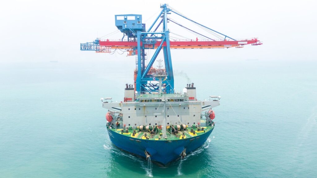
7. Water interface data
- Bathymetric soundings. Verify channel depth at minimum seasonal water levels plus clearance for barge rake.
- Dock load ratings. Record apron capacity and bollard pull to ensure winch forces stay within limits.
- Current, tide, and wind. Capture hourly readings over a full cycle to plan safe landing windows for roll-on or roll-off operations.
By the time this survey hits the client’s inbox, every dimension, clearance, and load rating should trace back to a documented measurement. That level of precision keeps permit engineers, insurance underwriters, and barge operators confident enough to green-light the move without asking for follow-up site visits.
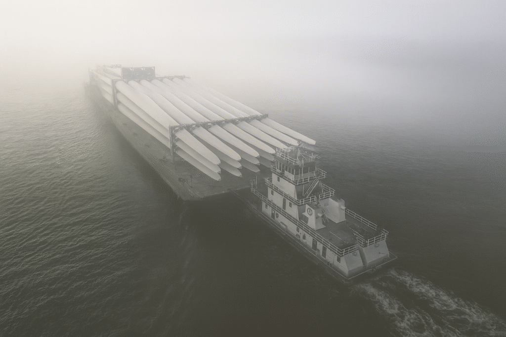
Marine Factors Most Teams Miss
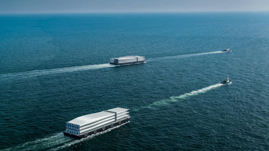
Once your heavy haul project touches water, a different set of risks come into play. River stages drop. Lock schedules shift. Ramp slopes that looked fine in planning become unworkable by the time the crew shows up. These issues can throw off the whole job if you’re not prepared. If you’re moving oversized cargo near water, this is where SEA.O.G becomes essential.
Heavy haul moves that include water bring a unique set of risks. Ramp slopes, tide windows, and lock delays can stall equipment on site longer than planned, increasing exposure to demurrage and detention fees that erode profit and frustrate stakeholders.
These variables can stall a project and drive up costs if they catch you off guard. SEA.O.G pays close attention to these details from day one so planners have a clear path forward.
What SEA.O.G plans for on every marine leg
- Draft restrictions: Seasonal water levels, sediment buildup, and dredging work affect how much draft is available. SEA.O.G reviews current gauge data and long-term patterns, then matches the cargo to equipment that can navigate those limits.
- Lock operations: Locks decide how fast a tow moves. Routine maintenance and seasonal traffic can add hours or even days. SEA.O.G checks lock schedules and historical trends early, then builds realistic transit times into the plan.
- Tow and barge configuration: Loaded draft, barge rake, horsepower, and channel width all influence route options. SEA.O.G engineers review these factors and recommend equipment that fits both the cargo and the waterway.
- Landing grades and dock access: Ramp slopes shift with each tide. A steep grade can stop self-propelled transporters, while a shallow grade can limit clearance. SEA.O.G surveys dock sites at multiple tide levels, then sets safe windows for roll-on and roll-off operations.
- Environmental and clearance conditions: Currents, wind forecasts, and bridge air-draft limits affect timing and safety. SEA.O.G gathers this information during planning and integrates it into schedules and contingency plans.
SEA.O.G provides feasibility studies, dock access checks, compliance planning, and field support that keep the marine leg on track. Our involvement gives project teams reliable information and actionable options before equipment is deployed.
Conclusion on Route Survey Process
Every successful heavy haul move starts with clear facts about the path in front of it. A complete route survey process gathers those facts, validates the exact route proposed, and shows planners where risk hides long before the first permit is filed. With hard numbers in hand, project managers protect budgets, schedules, and reputations.
SEA.O.G builds surveys that cover pavement, waterways, and every transfer point between them. We turn findings into practical plans, confirm equipment fit, and stay engaged while the cargo is in motion. If your move touches water, our marine team adds the dock measurements, lock timing, and tide windows that keep barges moving on time.
Bring us in early. We will help you lock in a route that owners, insurers, and field crews can support with confidence.
Key Takeaways
- A heavy haul without reliable measurements is a guess. A full route survey process changes that guess into a plan.
- Most oversized loads need boots on the ground to verify lane widths, bridge ratings, draft depths, and ramp slopes.
- Documented data speeds permit reviews and keeps inspectors from asking for repeat checks.
- SEA.O.G surveys water legs, then matches the exact route proposed to equipment that can navigate it safely.
Frequently Asked Questions
What’s the difference between a route survey and a general route check?
A general route check might involve looking at satellite images, permit maps, or previously used paths. A full route survey goes further. It includes physical site visits, clearance measurements, bridge load evaluations, and dock assessments. For oversized freight, especially loads with a width greater than standard lanes or complex marine components, a full survey led by an experienced route surveyor ensures the exact route proposed is feasible, safe, and approvable.
Do I need certified pilot car drivers for every move, or just the ones flagged in the survey?
Pilot car requirements vary by state and load dimensions. If your load exceeds thresholds for height, width, or length, a certified pilot car driver may be required—sometimes more than one. The route survey process helps identify these needs in advance so your specialized trucking company isn’t caught off guard by escort requirements or enforcement officers questioning compliance.
How often do route surveys need to be updated?
That depends on the route, the region, and the conditions on the ground. For frequently used corridors, a recent survey might still be valid if there have been no changes. But if you’re working near construction zones, ports, or jurisdictions with shifting regulations, surveys can go stale quickly. Any time the route changes, or if you’re moving an authorized vehicle with different specs than the last load, it’s smart to verify all details again before dispatch.